
Understanding Real Estate Legal Descriptions
Any time the word “legal” is involved it’s not usually very fun. So it’s no surprise that the term “real estate legal descriptions” doesn’t seem very interesting when you hear it.
But, it is important because legal descriptions tell you what real estate land you are acquiring and its accuracy matters. You can expect to find a legal description on each of these documents:
- Deed: a deed conveys ownership of real property from the grantor to the grantee. The legal description describes an exact explanation of what the grantee is receiving.
- Mortgage: a mortgage creates a voluntary lien on real property to secure repayment of debt. The mortgage needs legal description of the property since the property is collateral for the loan
- Title Insurance Policy: Title insurance protects the owner against losses due to undiscovered title defects and encumbrances on the property. The legal description defines exactly what is insured
We’re going to begin talking briefly about the 3 methods for determining and/or interpreting legal descriptions. You’ve probably heard of at least one of these methods before and are somewhat familiar but this guide should serve as a good reminder and educator for each of the three.
3 Methods for Legal Descriptions:
The following are 3 methods for legal descriptions:
- Metes and Bounds System
- Lot and Block System
- Government Survey System
Metes and Bounds System
It is used to define the location, size, and shape of a specific plot of land. It’s the oldest form of describing land and is typically used along the eastern seaboard. Metes stands for distance while bounds stands for direction.
A permanent marker, such as a rod driven into the ground, is often used today to mark a specific point of the property as a reference point. From the reference point, the description then gives distances and directions to outline the plot of land.
Why is knowing the metes and bounds system important? If you’re dealing with a lake or riverfront property, just one “frontage foot” could mean the difference of thousands of dollars in property value.
Lot and Block System
This system is typically used for platted property, which means property that has been subdivided. The property’s lot number and block number within a subdivision will be referenced and will require a surveyor to use a plat map to find the exact location. A plat map is simply a detailed survey map of a subdivision.
Government Survey System
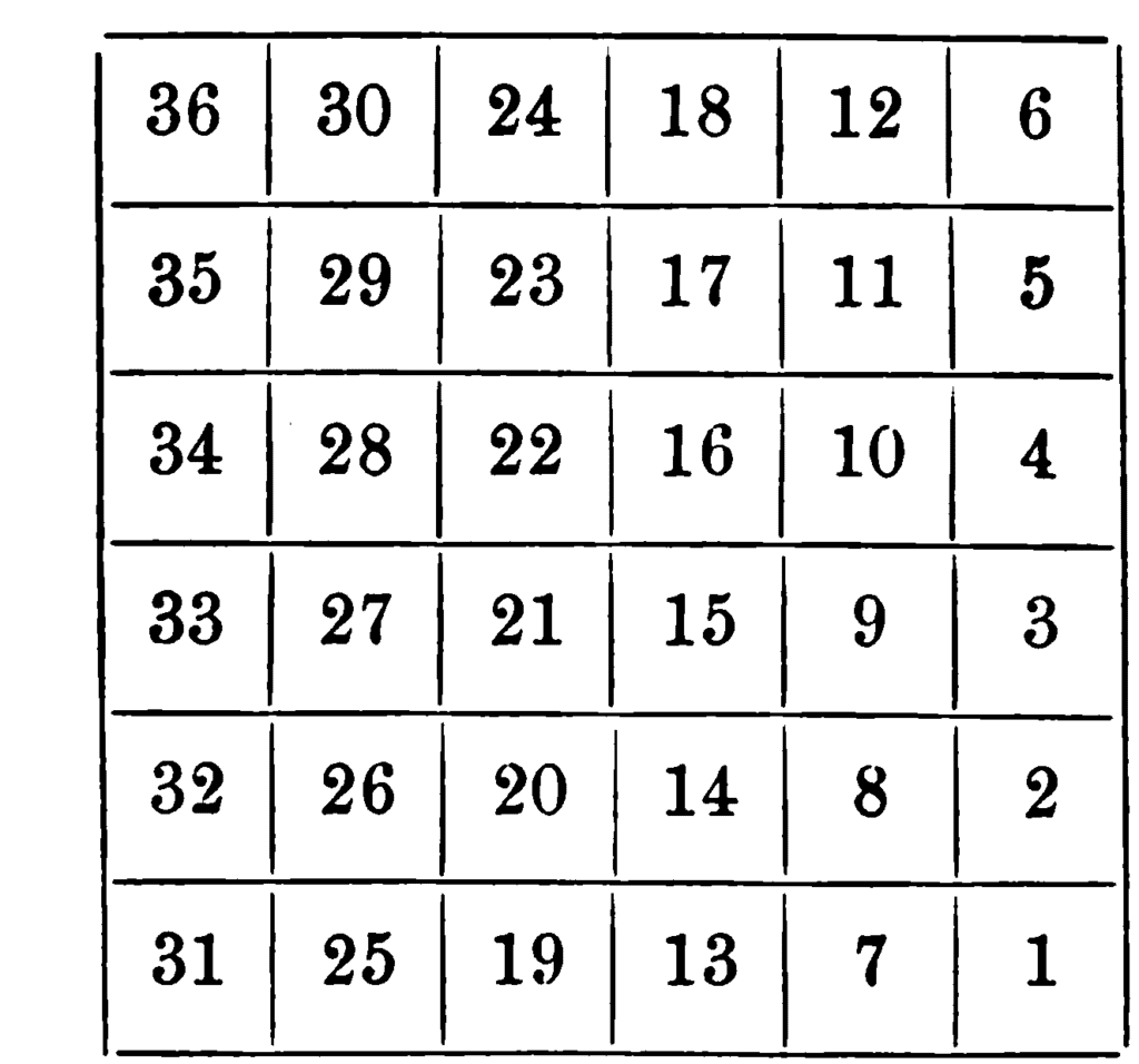
This method is also known as the rectangular survey method as land is divided into blocks. Principal meridians run north and south while base lines run east and west. You can think of a principal meridian as a vertical line that divides east from west while a base line runs horizontal dividing the north from south. Range lines also run north to south and are parallel to principal meridians every six miles. This divides land into six mile squares called townships. This 36 miles of land is divided into 36 sections of one square mile each.
In this system:
- 1 Township = 36 sections
- 1 section = 1 square mile = 640 acres
- 1 acre = 43,560 square feet
- 1 mile = 5,280 feet
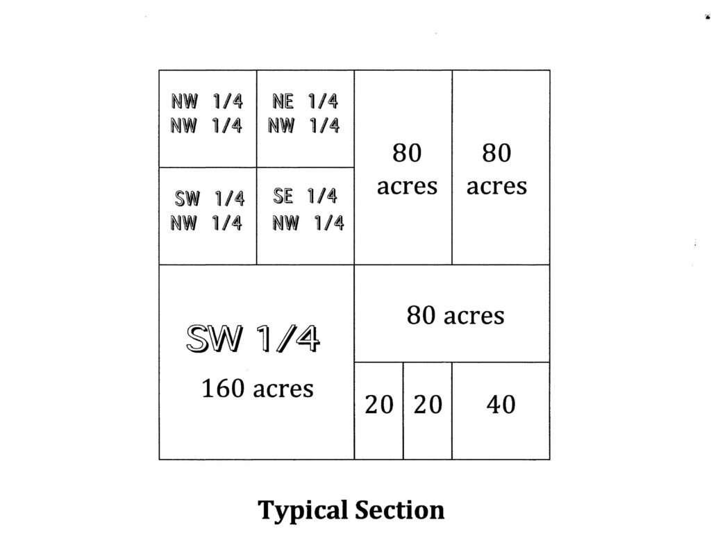
The section (one square mile) can be further divided into half and quarter sections. Therefore, a legal description might read N ½, NE ¼, of NW ¼, which would be a small block of land withing the bigger 1 square mile section.
You may also see a topographic map which shows the elevation of a particular section of land. Each contour line represents a 10 foot change in elevation. Slanted lands allow for rain run off and must be slanted properly away from the house to avoid water funneling to the basement.
Lastly, let’s conclude with some math practice.
Remember:
- 1 yard = 3 feet
- 1 square yard = 9 square feet
- 1 acre = 43,500 square feet
- 1 mile = 5,280 feet
To determine the area of land or a property, you’ll multiply length times width. If a property is 75 feet in length and 20 feet wide, the area would be 1,500 square feet.
To convert this to acres, you would divide by 43,500 square feet so 1,500/43,500 = .034 acres
When pricing real estate, you’ll often get a per square foot price or per acre price. For example, recent homes are selling in your neighborhood for around $100 per square foot. If the home is 1,500 square feet you can multiply it by the $100 per square foot to get a value of $150,000.
Contact Kevin Foy, Realtor
Kevin is a real estate broker-associate with RE/MAX Oak Crest Realty in Elkhart, Indiana and has served real estate clients for over 35+ years in Northern Indiana and Southern Michigan.
To get ahold of Kevin for real estate services:
- Phone: 574-536-9218
- Email: Kevin@TeamFoy.com
Or you can subscribe below to our monthly email newsletter to stay up to date with the latest real estate news, tips, and housing market reports. Thanks for stopping by today.